 History of Schmeeckle Reserve
Geologic History
A large mass of granite bedrock, part of the Wolf River Batholith, lies beneath Schmeeckle Reserve. In many places the bedrock is close to the
surface, leaving only a few inches of topsoil. The bedrock is like a giant bathtub, pooling water at the surface and creating
large wetland areas. Prior to settlement, the majority of Schmeeckle Reserve was covered by wetlands.
People often wonder about the boulders and rocks along the Reserve's trails. These were not deposited by glaciers. During the last part of the Wisconsin Glaciation about 10,000 years ago, the Green Bay Lobe of the ice sheet stopped just east of the Stevens Point area, where a long moraine ridge now stands. Water pouring out from the melting glacier covered the Stevens Point area in a level layer of sand (outwash plain), but didn't have enough force to carry large boulders. The rocks in Schmeeckle are actually part of the granite bedrock. Water seeps into the cracks and fissures of the bedrock, and as it freezes and thaws, pieces of the bedrock are cracked off and pushed to the surface.
Pre-settlement Era
The area that now makes up Schmeeckle Reserve was included in one of the earliest land surveys in the Wisconsin territory, offering a unique glimpse of the pre-settlement landscape. In 1836, the U.S. government signed a treaty with the Menominee nation to purchase several million acres lying between the Fox and Wolf Rivers in present Winnebago and Outagamie Counties. A special clause was inserted for the Menominee people to cede additional land on both sides of the Wisconsin River. Known as the "Lumberman's Treaty," this clause allowed logging and sawmilling in a three-mile wide strip along the banks of the river from Nekoosa to Wausau. When the contract was sent out to survey this "six mile strip," a man named Joshua Hathaway won the bid. In the spring, summer, and fall of 1839, Hathaway completed the survey of 184,320 acres of land.
Schmeeckle Reserve was included in the "six mile strip" along the Wisconsin River. Hathaway walked the township and range boundary lines, sketching a map and taking notes of the plants and habitats he encountered. These original notes provide an invaluable snapshot of Schmeeckle in the mid-1800s prior to European settlement.
Based on Hathaway's notes, Schmeeckle Reserve was largely composed of wetlands. His notes make several references to swamps and marshes: "Enter same marsh, Cranberries," "Leave tamarack swamp and marsh." The reference to cranberries and tamarack trees indicate a more acidic type of wetland, likely similar to sedge meadow habitats north of the Reserve. The large wetland complex covered over two-thirds of the present Reserve land, running from the northeast corner to the southwest corner, following where Moses Creek flows today. Interestingly, Hathaway does not make note of a stream; it is likely that the Moses Creek channel wasn't well defined, but rather a shallow wetland of slow-moving water with some braided rivulets, again similar to the sedge meadows to the north.
For the upland habitat in the northwest portion of the Reserve, Hathaway
described the landscape as "Sand, level, rocky, Aspen, W. Birch (paper
birch), W. & P. Pine (white pine and jack pine)." Surveys were
important to settlement, so Hathaway was describing the land's
suitability for lumbering and farming. These uses weren't ideal due to large swamps and rocky soils. Early settlers, however, found creative ways to extract resources from the land.
Logging Era
From the 1840s to the 1880s, Stevens Point was a hub of logging and lumbering activity. In 1853, a news correspondent visiting the city wrote,
"It is difficult to calculate the extent of the lumbering business on the Wisconsin River; at this place there are fourteen saws, constantly cutting lumber for the Mississippi market. There are scores of large stacks piled along the banks of the river waiting to be rafted and run down..." (Malcolm Rosholt, Our County, Our Story: Portage County, Wisconsin, 1959)
With its proximity to the Wisconsin River, Schmeeckle Reserve was likely logged over early during this period. A few individual trees, like 200-year old oaks found in the Berard Oaks Savanna, were spared from the axe and today serve as remnants of the original woodlands. After the cutover, the Chilla Woodlot in the northwest portion of the Reserve was protected by future landowners, and today features an old-growth forest with some trees 100 to 150 years old.
Farming Era and Moses Creek
After the trees were logged, farmers moved onto the land that would become Schmeeckle Reserve. The large wetlands were a barrier to agriculture, as they were in many other parts of the region. A common solution was to construct ditches that would drain the wetlands and make them farmable. An early advertisement from the Wisconsin Drainage Company stated:
"The price of land, interest and taxes are too high for land to be idle or raising wild grass. Why not drain it and raise crops or hay?" (Stevens Point Gazette, September 8, 1915)
An 1878 atlas map shows a "flood ditch" being proposed running through the northeast portion of what would become Schmeeckle Reserve. Sometime near the end of the 1800s, Moses Creek was channelized to drain the large wetlands that covered most of Schmeeckle. This drastically altered the ecosystem and its ability to buffer floods, causing major issues where Moses Creek emptied into the Wisconsin River near downtown Stevens Point. According to an article in the Stevens Point Daily Journal on June 29, 1897:
"Shortly after five o' clock a raging torrent came rushing down Main street... The rain continued and the tiny brook known as Moses Creek became a river, then a lake."
The lands that make up Schmeeckle Reserve were never highly productive for farm crops. Bedrock close to the surface made some areas wet
and difficult to drain, while other areas had shallow, dry, and sandy soils. Corn and grain crops were planted on some of the higher areas, but most of the
land was used for grazing dairy cattle.
Evidence of old farms can still be
seen in the Reserve: rusted farm machinery, foundations buried under
fallen leaves, straight ditches constructed to drain fields and
pastures to Moses Creek, barbed wire grown into the trunks of large
fencerow trees, piles of rocks picked out of the fields, and young aspen and red maple trees invading old
fields.
By the 1950s and '60s, many farmers
abandoned the infertile land and put their properties up for sale.
Fred Schmeeckle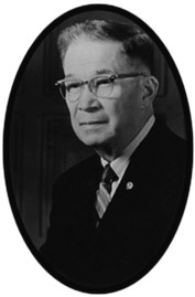
Fred Schmeeckle was a professor from Nebraska who arrived in 1923 to
teach at the Stevens Point State Normal School (now UW-Stevens Point).
Although he was appointed to teach agriculture, he believed that the
curriculum lacked an important conservation focus. He reminisced that:
"The destruction of forests, pollution of water, and misuse of wildlife
areas are factors that started me thinking something should be done to
educate people in the wise use of resources."
In the early 1930s, Schmeeckle began teaching conservation courses,
which developed into the first conservation education major in the
country. It focused on providing training for students to teach others about conservation principles. This program grew into the College of Natural Resources, now the largest undergraduate natural resources program in the nation.
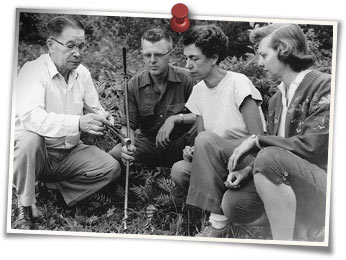
Schmeeckle often took his classes on field sessions in the area north
of campus that was transitioning from farm fields back to a natural
state. In 1958, while speaking about a recent purchase of land north of campus, Schmeeckle declared:
"Someday this area will serve as
an island of green in the City of Stevens Point."
When the Reserve was
created nearly 20 years later, Fred Schmeeckle became the deserving namesake
of the natural area.
UW-Stevens Point Land Acquisition
Starting in 1956, the University of Wisconsin System began purchasing parcels of the agricultural land north of campus for future expansion.
One of the first projects undertaken by the UWSP Foundation in 1967 was the purchase of approximately 50 acres owned by the Atwell family, where the lake eventually would be excavated. By 1969, the university owned 127 acres of this undeveloped land.
The area was considered for many uses including residence halls,
married-student housing, a physical education building, and athletic
fields.
University students, however, always valued the natural character of the new land. In 1961, the Alpha Kappa Lambda conservation fraternity developed a small "College Park" on the east side of Reserve Street in the newly purchased woodland. The park featured picnic tables, trash cans, charcoal grills, and short nature trails. The concrete foundation of a grill can still be seen along the Granite Parkway today.
Fires lit by careless travelers flicking cigarettes out of
their windows burned through the natural area several times. Students
from the university's Conservation Department were more than happy to
abandon their studies in favor of fighting forest fires. Furrows dug by the forester's plow to
stop the flames can still be seen snaking through the Reserve.
Sentry Insurance and Lake Joanis
The construction of Sentry Insurance's world headquarters led to major changes that facilitated the creation of the Reserve.
Local
leadership anticipated a major increase in traffic for employees driving
to and from the new Sentry Headquarters. In September 1974, the UW Board of Regents reached agreement with the City of Stevens Point. In 1975, Reserve Street, a road
that ran through the middle of campus to the new headquarters, was abandoned to reduce the danger to students and the corridor was turned over to the university. Reserve Street was reconstructed into a walking and biking trail now called the Granite Parkway. You can still see fire hydrants along the trail. To provide another option for Sentry traffic, the university granted an easement to the City to extend Michigan Avenue on the east side of campus. This extension was hotly debated by students,
faculty, and community members, as it divided the newly established
natural area in half.
Sentry also needed fill for their new building site. In 1974, Sentry Insurance began discussions with the UW-Stevens Point Foundation to excavate the
necessary soil from the foundation's 50-acre tract. A plan was formulated to create a 24-acre spring-fed lake that would not only provide fill, but also benefit the university and Stevens Point community. The engineering design incorporated a natural curving shoreline and various water depths (to a maximum of 27 feet) to maximize wildlife habitat and recreational opportunities. Moses Creek would be diverted around the lake to avoid excessive nutrient
contamination. And a water level control pipe would be installed to maintain
appropriate water depths for fish and waterfowl. The excavation was started in fall of 1975 and completed in 1976, at a cost of about $1 million to excavate over 850,000 cubic yards of soil.
The lake began filling with groundwater and was an immensely popular swimming area for college students. Unfortunately, the hundreds of sunbathers and swimmers also caused severe erosion along the sandy shoreline. In summer of 1977, a moratorium was placed on swimming in order for shoreline vegetation to take hold. By the spring of 1978, the water level had reached its maximum extent. The lake was officially named Lake Joanis in 1994 after former
Sentry Insurance President John Joanis, who paid for its excavation.
Establishment of Schmeeckle Reserve
In 1975, a university committee was formed called
the North Campus Planning and Utilization Committee to determine the
future of the university land that had been acquired. In 1976, they
reported that:
"The greatest value to the University of the vast majority
of the north campus land, is its aesthetic contribution to our rapidly
urbanizing campus environment, and its fundamental support of our
natural resource and biology curriculum... All undisturbed land areas of
the UW-Stevens Point and UW-Stevens Point Foundation between North Point Drive and Maria Drive should be designated an Environmental Laboratory..."
The committee also established the use priorities that still serve as the foundational mission of Schmeeckle Reserve:
"1. Use as a natural area, preserving wild features for their aesthetic value, 2. Use for education (compatible with first priority), 3. Use for recreation (compatible with first and second priorities)."
In June 1977, the 176-acre natural area was officially established and named Schmeeckle Reserve in honor of Fred J. Schmeeckle, a professor at UW-Stevens Point who pioneered the nation's first conservation education department.
Duane Gruel, a graduate of the UW-Stevens Point wildlife program, was hired in 1977 to lead a crew in managing the new natural area. The crew included about 17 people hired under state and federal programs intended to ease unemployment. The crew built a trail around the lake, constructed and installed birdhouses, planted vegetation along the lake shoreline and island, landscaped, and planted trees and shrubs.
In 1977, UW-Stevens Point submitted a proposal for a Federal Land
& Water Conservation Fund (LWCF) grant to improve the lake area, build a fitness trail and walking trails, landscape old Reserve Street, and construct a shelter building. The next year, a $267,238 grant was awarded to UW-Stevens Point, the largest ever appropriated to a state campus at the time. The UWSP Foundation donated its 50-acre parcel with
the lake to UW-Stevens Point as an in-kind match for the grant, and this was the largest property gift given to a UW System campus at the time. Never before had a university project been undertaken involving joint participation of a university, private business, and city.
Schmeeckle Reserve Grows
The first director of Schmeeckle Reserve, Ron Zimmerman, was hired July 1, 1979. With the assistance of a student crew, he guided the development of trails, facilities, and landscaping that were specified in the LWCF grant.
The acquisition of additional green space has been a priority since the beginning of Schmeeckle Reserve. In 1979, the university was awarded an additional $167,475 LWCF grant for purchasing 20 acres north of the lake. In 1982, 10 acres were purchased that included a ranch-style home owned by the Edward Wojcik family. Over three years, students converted the house into the Schmeeckle Reserve Visitor Center. The garage became a meeting room and the old bathroom became the front desk area. An additional 10 acres were acquired in 1983 just east of the visitor center that included a house owned by Walter and Esther Skowronski. This house was removed and the impacted area was turned into the visitor center parking lot. A 1-acre prairie was established south of the parking lot.
When the Wisconsin Conservation Hall of Fame (WCHF) was created in 1984,
Schmeeckle Reserve became its new home. In 1990, the WCHF constructed an addition to the Schmeeckle Reserve Visitor Center with funding from the
city's motel-room tax and more LWCF funding. The addition included a walk-through exhibit area, formal Hall of Fame gallery, meeting room, and sign-making shop.
In 1996, the UWSP Foundation donated 14.25 acres east of the visitor center and parking lot parcels. This was used as a match for 15 acres that were acquired along Moses Creek on the east side of the Reserve through a $64,000 Knowles-Nelson Stewardship Grant (in cooperation with Portage County). In 1998, 44.8 acres were acquired along North Point Drive through a $214,140 Knowles-Nelson Stewardship Grant (in cooperation with the City of Stevens Point). This acquisition included a historic oak savanna area with trees over 200 years old. The landowner, Hatch Berard, generously donated the last 4 acres as a match for the grant, and the area was named the Berard Oaks.
In 2008, the Milano and Sciarrone families donated a 5-acre triangle of land in the southeast portion of the Reserve, which included about 700 feet of Moses Creek. With this donation, all of Moses Creek between North Point Drive and Maria Drive (except a small inholding stretch) was owned by the university, and this served as a catalyst for restoring the creek and wetlands.
Moses Creek had been ditched since the late 1800s to drain wetlands for farming. In February 2010, an agreement between the Wisconsin Department of Transportation (WisDOT) and UW-Stevens Point led to a major restoration of the Moses Creek corridor. In summer and fall of 2010, 17 acres of soil was excavated to create diverse wetlands and pools. A new shallow stream channel was established with natural meanders. Trees, shrubs, and wetland vegetation were planted in the restored area. The $900,000 restoration was funded as a mitigation project by WisDOT. The restoration was officially opened in a ceremony on May 11, 2011.
In October 2011, the Victor Hytry family donated a 1/2-acre inholding along North Point Drive to complete the contiguous university ownership of land.
Schmeeckle Reserve continues to explore opportunities for green space acquisition and development of facilities that improve educational and recreational experiences for the community. The Reserve truly has become an expanding "island of green" that Fred Schmeeckle envisioned so long ago.
 Skip to main content
