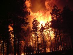
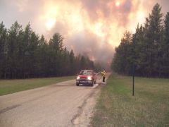
Geographic Documentation of the Cottonville Fire - Adams County, Wisconsin - May 5, 2005


Project Abstract
On May 5, 2005, a man clearing his land near the unincorporated
community of Cottonville, Wisconsin in Adams County ignited what has come to be
known as the Cottonville Fire. The fire burned 3,410 acres through the
communities of Big Flats, Preston and Culburn and destroyed 30 homes and dozens
of other structures. Ironically, the landowner used fire to clear his land to
make it less susceptible to wildfire.
The
Cottonville Fire is one of the most thoroughly documented major fires in
Wisconsin history. Technology has afforded the means to quickly collect and
present documentation of the fire with maps, photographs, damage assessments,
after action reviews, and other records. Initial documentation was centralized by the Wisconsin
Department of Natural Resources (WDNR) using Esri's ArcView 3.X software –
GIS software popular in the 1990’s and early 2000’s. Project files and data were shared with the
UWSP GIS Center for publishing and serving data on the internet for public
consumption and education. The resulting web-maps provide a
geographically-enabled means to warehouse information, communicate a complex
spatial narrative and promote better understanding about wildfire.
Principal Investigators
John Hintz: WDNR Forestry Staff Specialist. Project advisor.
Douglas Miskowiak: UWSP GIS Education Specialist. Project advisor.
Al Bond: UWSP Senior Technical Support Specialist. Technical advisor.
Student Investigators
Ben Overholt: GIS Database Management and Cartography.
Stephen Kochaver: GIS Server Administration and Java Script Programming.
Interactive Web Mapping
Click on one of the headings below to open a web browser and interactive map using Esri's Flex Viewer Application. These maps share a comprehensive set of spatial information compiled about the Cottonville Fire.
Fire Timeline and Emergency Response
Pre/Post Fire Imagery and Land Cover Changes
Documentation of Fire-in-Progress, Fire Effects and Management Plans
Data Descriptions
Click here to learn more about the various data layers compiled for the Cottonville Fire. Learn which layers have additional interactive functions that link to photographs and other content.
After Action Review
Click here to review the final report and after action review of the Cottonville Fire written by the Wisconsin Department of Natural Resources.
